Entry Points:

About La Paz County
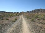
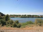
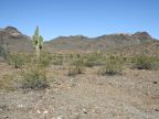
La Paz County covers 4,513 square miles along the western boundary of Arizona in the lowlands along the Colorado River and the adjacent hilly country. The Colorado River is the lifeblood of the county, providing irrigation water for farming. Watersports also draw many tourists and retirees to the area along the river. Because of the low elevation along the river, and its inland location, the climate is very hot.
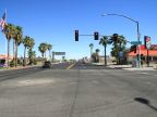
La Paz County is among the newest counties created in America. It was established in 1983, by a vote of the residents, being split off of Yuma County, which lies to the south. It is the only county to have been created in Arizona since it became a state, and because of its shortage of funds at the outset, laws were changed to make it much more difficult to create a new county in Arizona. The county seat is at Parker. Quartzsite is the largest city.
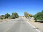
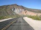
The lowest elevation in La Paz County is close to 200 feet at the point where the Colorado River flows southward out of the county. The highest point is 5,681 feet at Harquahala Mountain near the county's eastern border. Interstate 10 is the main route of travel through the county, heading east-west and passing through Quartzite. U.S. Highway 95 passes through the southern part of the county, reaching the town of Quartzite, where it joins I-10 and heads west into California. Arizona Highway 95 heads northward out of Quartszite, connecting to Parker and further north. U.S. Highway 60 accesses areas in the eastern part of the county, joining the freeway near Quartzite.
For More Information:
See the official site of La Paz County at www.co.la-paz.az.us, and Wikipedia's La Paz County article.