Entry Points:

About Quartzsite
Quartzsite is a town of 3,397 people (2006 estimate) about twenty miles from the California-Arizona border in western Arizona. It lies in a long valley known as the La Posa Plain, near the Dome Rock Mountains, which line its western edge. The area is part of the Sonoran Desert, characterized by saguaro and cholla cactus, ocotillo and creosote bushes. The creosotes fill the plain, while the cactuses are found more commonly on the mountains. The climate is very hot with an average daily high of 87 degrees for the whole year, and about 4 inches of rain a year.
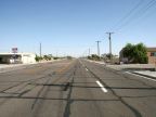
Interstate 10 passes through Quartzsite, heading east and west. It leads to Ehrenberg to the west, a small town on the Colorado River. To the east it passes through a sparsely settled country, with no major towns until it reaches the Phoenix suburbs eighty miles away. The freeway brings many travelers through Quartzsite, for whom it provides a convenient place to stop for gas and food. This is probably the major source of economic activity for Quartzsite. U.S. Highway 95 also serves Quartzsite, heading southward from town towards Yuma. The highway joins the freeway at Quartzsite to cross the Colorado River before heading north again on the California side of the border. Arizona Highway 95 continues north from Quartzsite, leading to Parker.
In the past, this part of Arizona was a major mining area and old mines and prospects are scattered through all the surrounding mountains. Quartzsite was originally called "Tyson's Well" after the well dug by a miner named Tyson in 1864. In those days it was an important watering stop on the Ehrenberg-Prescott stagecoach route. Along with valuable minerals, quartz deposits are scattered throughout the area, for which Quartzsite was later named. Mines ran later out and/or became unprofitable in the regimented modern economy, leaving the area without much industry.
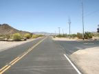
With the hot climate at Quartzsite, it becomes a winter home to many retirees who, living in cold climates, come here for the cool part of the year. The surrounding desert is not entirely barren, and provides a wide open expanse for exploring and enjoying the exotic vegetation. Many dirt roads wander through the desert, leading often to old mines. Take plenty of water while exploring these areas.
Quartzsite is the largest of the traditional towns in La Paz County. The elevation ranges from about 820 to 920 feet. The Tyson Wash (a dry riverbed) flows northward through the center of town.
For More Information:
Quartzsite has its official town website at www.ci.quartzsite.az.us. See also Wikipedia's Quartzsite article.