Entry Points:

About Desert Springs
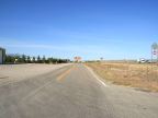
Desert Springs is a small retirement community that has sprung up along Interstate 15 in the desert in the northwestern tip of Arizona. It overlooks the Virgin River to the north , with the Beaver Dam Mountains on the south and east. The freeway disappears into the Virgin River Gorge just to the east, a dramatic cut through the mountains. Just to the west it crosses the Virgin River on a large bridge. The towns of Littlefield and Beaver Dam are on the other side of the river, and the freeway is the only way to get there.
The ground slopes upward from the river towards the mountains, and is mostly covered with creosote bushes, characterized by tiny dark green leaves, and yellow flowers in the spring. Trees and grass grow along the river bottoms, and otherwise the terrain looks very desolate. To the west the desert stretches for many miles, an impressive, wide expanse. The city of Mesquite, Nevada is about 10 miles east, but hidden from view.
Desert Springs and its two companion towns are isolate in the corner of Arizona, there being no paved road to connect them to any other location in Arizona. The Grand Canyon lies on the other side of the mountains, and cuts off any access in that direction.
Desert Springs is unincorporated and no population figure is available, but it is probably in the hundreds. Other than the freeway, no roads leave the town except a few dirt roads leading up into the mountains.