Entry Points:

About Mohave County
Mohave County covers 13,470 square miles, a very large area, in the northwest part of Arizona. The Grand Canyon divides the county into two parts with an impassable gorge which no road crosses. The Colorado River, after flowing of the the Grand Canyon, enters Lake Mead and then turns south and forms the western boundary of the county. The seldom-visited Grand Canyon-Parashant National Monument lies in the northern section of the county.
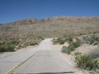
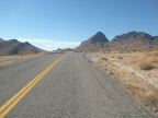
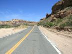
The terrain of Mohave County is very rugged with steep, rocky mountains, and deep gorges. Deserts fill wide valleys between mountain ranges, with a sparse covering of creosote and tumbleweeds, ocotillos and other desert plants. The lowest elevation in the county is 450 feet at Lake Havasu, and it rises from there toward the north and east. The Hualapai Mountains, near Kingman (the county seat), rise to 7,000 feet, high enough to capture moisture from passing clouds.
Edward Beale and Lewis Kingman were early explorers and surveyors of the region. Edward Beale layed out a wagon route through northern Arizona to the Colorado River. Lewis Kingman then surveyed the same route for the railroad. U.S. Highway 66 was later built along the wagon route, becoming a major factor in the settlement and development of the area. It has now been replaced by Interstate 40, but the original route can be followed through most of its length across the county. Gold and silver were discovered in the mountains around Kingman, and the remnants of many mines and mining camps can be seen today.
155,032 people live within the county, as of the 2000 census. In addition to Interstate 40, U.S. Highway 93 traverses the county from northwest to southeast. Interstate 15 cuts through the remote northwest corner, through the Virgin River Gorge, connecting Utah with Nevada. Arizona Highway 389 accesses a segment of the northern edge of the county. The Kaibab, Fort Mojave and Hualapai Indian Reservations cover parts of the county.