Entry Points:

About Maricopa County
Maricopa County includes Arizona’s capital city, Phoenix, and much of the populous areas surrounding it. The population was 3,817,117 at the 2010 census, which placed it as the fourth most populous county in the United States. It also has a large land area, 9,224 square miles. Desert climates cover the county. Saguaro and cholla cactus are common, along with creosote bushes, and many other exotic desert plants. The Sonoran Desert covers the southwest portion of the county, and the Mogollon Rim lines the northeast corner.
The empty desert lands and warm climates have invited a huge influx of population, and Phoenix and its suburbs have grown exponentially for decades. Three of the ten fastest growing towns in America were in Maricopa County. But beyond the reach of the city, there are still many miles of empty desert.
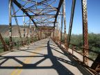
The Gila River is the major river in Maricopa County, entering from the southeast, flowing towards the center of the county, and then taking a turn to the south. Its sources lie in Black Mountains in New Mexico. Irrigation water from the river is in high demand, along with the domestics needs of millions of people, and it flows intermittently once it reaches the valley south of Phoenix. Only a small portion of its historic flow reaches the Colorado River today. The lowest point in Maricopa County is where it exits the county, at about 425 feet. The Salt River and Agua Fria Rivers join it near Phoenix.
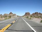
Numerous minor mountain ranges are included in Maricopa County. The The Harquahala Mountains reach above 5,000 feet on the west boundary. The Estrella Mountains reach to about 4,300 feet south of Phoenix, and the White Tank Mountains reach above 4,000 feet, just west of Phoenix. These mountains may look barren at a distance, but are usually covered with cactus, especially saguaro, cholla and jumping cholla. The highest point in Maricopa County is probably Browns Peak, at 7,657 feet, on the Mogollon Rim, shared with Gila County, to the east.
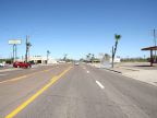
Interstate 10 heads west out of Phoenix towards California, and southeast towards the Tucson area. Interstate 17 heads north to Flagstaff. U.S. Highway 60 comes down the Mogollon Rim into Phoenix, and then heads into the northwest corner of the county. U.S. Highway 70 also enters the county from the east and terminates at a junction with Highway 60. U.S. Highway 80 also used to cross the county, as well as U.S. 89, but both have been replaced by freeways. Many other highways and roads access the area.