Entry Points:

About Springerville
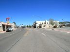
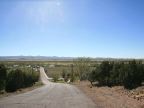
Springerville is located in Round Valley between the Little Colorado River and Nutrioso Creek. It is high in the White Mountains, at an elevation of 7,000 feet, and the peaks of the mountains rise prominently to the south, covered in green vegetation. The mountains are volcanic and cones and craters and lava flows can been seen throughout the surrounding country. The elevations of the mountains reach to nearly 10,000 feet. A 150-foot tall hill rises on the south edge of Springerville, the top of which serves as the cemetery.
Springerville has a close neighbor to the south, named Eagar. Along with a scattering of other houses in the valley, they are known collectively as Round Valley, and several thousand people live here. The Little Colorado River has its source in the White Mountains, and flows past Springerville on the east, heading northward. It eventually joins the Colorado River far away in the Grand Canyon. Nutrioso Creek flows past town on the north side and joins the Little Colorado.
Springerville was named after Henry Springer, who relocated from Albuquerque to establish a store. The town was named after him on May 10, 1876, but was not incorporated until 1948. The population was estimated to be 9,956 in 2006.
U.S. Highways 60, 180 and 191 pass through Springerville on a combined route on Main Street, heading east-west. At the west end of town they turn to the north. On the east end of town, highway 180 and 191 separate and head southward, while highway 60 continues east into New Mexico, about 15 miles away. The elevation varies from 6,940 on Nutrioso Creek to 7,121 feet at the cemetery.
For More Information:
See the official town website, or the Wikipedia Springerville, article.