Entry Points:

About Nutrioso
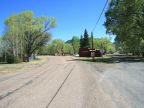
Nutrioso is a village in the White Mountains, built at the edge of a meadow at the feet of Escudilla Mountain. The elevation is a lofty 7,675 feet, making for cold winters and late springs. Nutrioso Creek flows through the town, but is small and sometimes goes dry. The mountain slopes are covered with pine and aspen right to the edge of town.
Nutrioso is unincorporated and no official population was available, but it must be around 200. U.S. Highways 180 and 191 (a combined route) used to pass through the center of town but has been rerouted to pass around it. It leads to Springerville to the north and Alpine to the southeast.
Escudilla Mountain stands just east of Nutrioso, a flat-topped mountain with its highest point at 10,877 feet in elevation. Visible for a hundred miles to the north, it is a beautiful, forested alpine paradise.