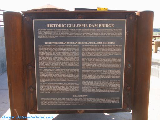
Historic Gillespie Dam Bridge
The historic Gillespie Dam Bridge spans the Gila River on Old US 80 Hghway, between the communities of Arlington and Gila Bend.
Built in 1927 as a federal aid project, the bridge is a unique and elegant reminder of Arizona's rich past and America's transportation
history. The bridge is listed on both the Arizona State and National Register of Historic Places and is referred to in the Historic
American Engineering recorded as a significant technological accomplishment in twentieth century engineering design and
construction. During the winter of 2011, the bridge underwent a $7.3 million rehabilitation effort by the Maricopa County
Departmnet of Transportation. This project was designated a 2012 Arizona Centennial Legacy Legacy Protect and included the contruction of this interpretive plaza.
The Historic Ocean-to-Ocean Highway and Gillespie Dam Bridge
In 1909, Arizona's territorial legislature created the office of
the territorial engineer to develop a sstem of roads
connecting Ariona's major cities and towns and improve the
delivery of the US Mail. The automobile was steadily gaining in
popularity and rutted, dirt wagon roads were no longer
suitale for this new means of transportation. Shortly after
Arizonas statehood in 1912, the state engineer surveyed a major
east-west transportation rute across southern Arizona
between the towns of Clifton and Yuma. This early highway
route followed the Gila River west from Phoenix, turning
south near the small town of Arlington where the Hassayampa
River and Gila River meet. The original highway route then
turned westerly through the then popular hot springs resout
of Dome until 1915, when a bridged crossing was constructed
further upstream at Antelope Hill. This highway route,
however, proved to be unreliable due to frequent washouts
during heavy rains and flooding.
In 1921, the highway route was realigned to ford the Gila River
just below the newly constructed Gilespie Dam. Heading
southt towards Gila Bend, the new route was known as the
Pheonix-Yuma highway. The following year, the Arizona
Highway Department built a concrete apron on the
downstream side of the Gillespie Dam to help automobiles to
cross the Gila River. This crossing point also proved to be
unreliable, As high water often made passage difficult.
Between 1922 and 1926, large trucks, tractors, and horse teams
were frequently used to pull automobiles across the apron of
the dam.
The Arizona Highway Department set about designing an all-
weather bridge structure in 1925 to span the Gila River. At this
location, construcftion of the Gillspie Dam Bridge began in
February 1926 and later that same year, the American
Association of State Highway Officials adopted our present day
highway nmbering system, when the new Gillespie Dam Bridge
opened to traffic on August 1, 1927. It was officially designated
part of the early southern transcontinental US 80 Highway.
Lee Moor Construction of El Paso, Texas bult the mine-span
steel truss bridged crossing of the Gila River for a cost of
$320,000. The 1,662-foot-long Gillespie Dam Bridge was nique for
its time and one of the longest bridges and the largest steel
structure in the state. Al of Arizona's major bridges before
this were built using reinforced concrete arches which proved
to be no match for swollen, flooding rivers. The new design
produced a more durable and flexible bridge that could
better withstand the force of flood waters.
Bridge design elements include a connected series of rigid
through trusses weighing 2.3 million pounds. The bridge has a
total of nine steel truss spans - five 200-foot-long trusses
centered over the river channel, flanked by two 160-foot -long
trusses at each end. Each steel truss features a camelback web
configuration with a built-up box beam for the upper and lower
steel members. The trusses are supported by solid concrete
abutments and pier columns placed on bedrock at a depth of 25
feet, with the deepest pair extending 43 feet below the riverbed.
The new bridge and US 80 Highway through the Arlington Valley
became part of the National "Ocean-to-Ocean Highway'
Gillespie Dam Bridge carried US 80 transcontinental traffic
from 1927 until 1956, when US 80 Highway was shifted east to
Rainbow Valley and the Arlington Valley stretch was
decommissioned as an interstate rute. The operation, care and
ownership of the bridge were then transferred from the state
of Arizona to Maricopa County.
Where the bridge no longer serves as a segment of the
interstate highway system, it is continually used by locals and
is enjoyed by travelers who bypass the newer highway to take in
a glimpse on an era gone by. Today, historic Gillespie Dam Bridge
on Old US 80, nestled between the Buckeye Hills and the Gila
Bend Mountains, serves as an integral plan element in the
Arizona Department of Transportation's statewide bicycle
system plan, the Maricopa County Department of
Transportation's bicycle transportation system plan and the
Maricopa Associatio of Governments Regional Bikeways Plan.
Gillespie Dam
The Gillespie Dam was built in 1921 by Frank Gillespie to supply water to his Paloma Ranch. At the time, it was the largest privately
financed concrete irrigation diversion dam in Arizona. The concrete dam was the last of four dams built at this site. The others
were made of earth, stone, or wood, and were washed out by floods on the Gila River. The current dam was breached in 1993, which
was one of the largest dam failures in Arizona History. Another site associated with the construction of the dam and bridge is the
Gillespie Dam Construction Camp. The site contains remnants of the machinery and structures used to build the dam, including an
innovative pulley sysdtem for delivering concrete during construction.