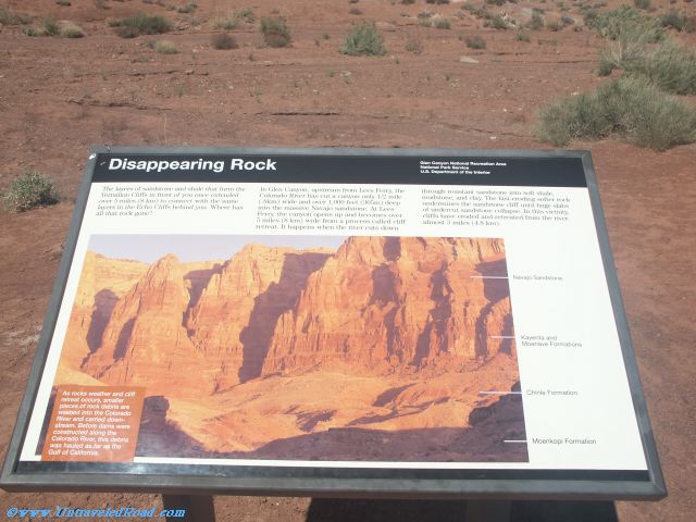
Disappearing Rock
The layers of sandstone and shale that form the
Vermilion Cliffs in front of you once extended
over 5 miles (8 km) to connect with the same
layers in the Echo Cliffs behind you. Where has
all that rock gone?
In Glen Canyon, upstream from Lees Ferry, the
Colorado River has cut a canyon only 1/2 mile
(.8km) wide and over 1,000 feet (305m) deep
into the massive Navajo sandstone. At Lees
Ferry, the canyon opens up and becomes over
5 miles (8 km) wide from a process called cliff
retreat. It happens when the river cuts down
through resistant sandstone into soft shale,
mudstone, and clay. The fast-eroding softer rock
undermines the sandstone cliff until huge slabs
of undercut sandstone collapse. In this vicinity,
cliffs have eroded and retreated from the river
almost 3 miles (4.8 km).
As Rocks weather and cliff
retreat occurs, smaller
pieces of rock debris are
washed into the Colorado
River and carried downstream.
Before dams were
constructed along the
Colorado River, this debris
was hauled as far as the
Gulf of California.

Don't miss the rest of our virtual tour of Glen Canyon National Recreation Area in 355 images.